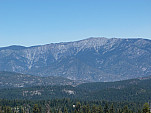
Hiking Buena Vista Peak

P1160363.jpg: 4320x3240, 5356k (May 01, 2015, at 02:13 AM)
Buena Vista Peak

Distance: 3 km (1.86 mi)
Duration: 1 hours
Total Elevation Gain: 130 m (426.4 ft)
Total Elevation Drop: 130 m (426.4 ft)
Trail Condition:
Overall Difficulty:
Scenery:
Overall Rating:

Hiked on June 29, 2014.

Elevation Profile.png: 750x500, 31k (May 01, 2015, at 02:12 AM)
Elevation Profile
Topographic Map.png: 1280x1024, 985k (May 01, 2015, at 02:12 AM)
Topographic Map
Google Earth.jpg: 1920x1001, 535k (May 01, 2015, at 02:12 AM)
Google Earth

Trail Head:

center=36.718172,-118.897049 zoom=10
36.718172,-118.897049
Buena Vista Peak

Get directions to the trail head.


Photos:

P1160318.jpg: 4320x3240, 5828k (May 01, 2015, at 02:12 AM) P1160321.jpg: 4320x3240, 5767k (May 01, 2015, at 02:12 AM) P1160363.jpg: 4320x3240, 5356k (May 01, 2015, at 02:13 AM) P1160364.jpg: 4320x3240, 5557k (May 01, 2015, at 02:13 AM) P1160365.jpg: 4320x3240, 4980k (May 01, 2015, at 02:13 AM) P1160366.jpg: 4320x3240, 5390k (May 01, 2015, at 02:13 AM) P1160382.jpg: 4320x3240, 5259k (May 01, 2015, at 02:13 AM) stitch0.jpg: 20388x3187, 14145k (May 01, 2015, at 02:12 AM) stitch1.jpg: 18401x3259, 14508k (May 01, 2015, at 02:12 AM) stitch2.jpg: 11538x3564, 9319k (May 01, 2015, at 02:12 AM)